Showing posts with label central transit corridor. Show all posts

Friday, March 15, 2013

Encouraging Developments

Edit: video was moved to a new location, link fixed.

It's sometimes hard to spot concrete evidence of actual progress in our community on a week-to-week, month-to-month scale. But if you look closely, the signs are there. Kitchener-Waterloo is evolving.

A major obstacle in the face of intensification-- namely, mandatory parking minimums in new development-- is starting to erode. There are two reasons why parking minimums are so damaging to urban areas:
  • Vehicle use is ultimately a function of the space devoted to vehicle storage. An oversupply of parking encourages car use over other modes, even when that contributes to congestion and when a car is not necessary for certain trips.
  • People love free parking, but the cost of providing it is high: borne in construction costs for buildings which must provide parking structures to hit their target density, or more often just borne in wasted surface space that spreads a city apart like stretching at a piece of fabric. This decrease in density, in turn, makes the city less navigable without a car.
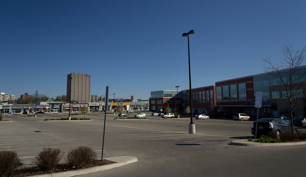
Ever been to the Sunrise centre? Have you parked at one store, shopped, and then driven to your next stop within the same plaza? I know I have. And the reasons are (a) there is an incredible abundance of parking that I can get close to each store, and (b) the incredible abundance of parking pushes all of these stores so far apart around a windswept, concrete expanse that I don't want to walk. These traits apply doubly for the ironically named "Boardwalk".

The blight even divides Uptown from surrounding neighbourhoods.

Cities in North America have mandated parking minimums built into their zoning rules for virtually every use, on the logic that a new development will increase the need for parking (which is often true). But parking is created in such quantities, and for singular purpose, that taken as a whole there is vastly more parking than we need in virtually all parts of our communities. And often when parking is tight, there is still plenty of supply available, but a territoriality (Parking for Customers Only!) that precludes using it.

That's just the supply side, and I'm not going to touch the demand side beyond suggesting you google "The High Cost of Free Parking" by Donald Shoup.

Back to KW.
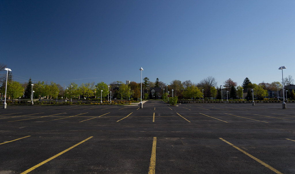
This massive Sun Life parking lot straddles the border of Kitchener and Waterloo.

We're not yet at the point where our municipalities are ready to sit down and say "fine, no parking minimums". Our downtowns are (in my opinion) quite ready to let the market drive the amount of parking a new development should provide, but our governments are not ready to make the leap even for our densest, best transit-served areas. But the good news is, we are inching closer.

The Transit Hub at Victoria & King

Aiming to combine LRT, bus, GO, VIA and Greyhound all at the same location-- along with residential and commercial uses, the block bordered by King, Victoria, Duke and the CN tracks has (I believe) now been zoned with a reduced parking minimum of 0.7 spots per dwelling unit for the residential use. (There will also be parking for other purposes at the site.)


This is important, because it will mean that many new residents at this location-- possibly the most accessible location without a car anywhere west of the GTA in Ontario-- will purchase units without a parking spot at all.

It also sets a precedent that Kitchener is open to negotiating on parking minimums. If the market doesn't justify a certain level of parking, developers will be happy to forgo the expense of it, and it appears that at King and Victoria at least, these conditions are expected to exist.

Interestingly, diagonally across the street is the One Victoria development. The company building this, too, is seeking reductions in parking minimums. If there's anywhere in KW this is justifiable, this corner that has access to All The Transit has got to be that place.

Now all the downtown needs is a supermarket.


Meanwhile, what's going on north of the border? Last we checked, Waterloo seemed to be struggling with its priorities, as the 155 Caroline project edges ever closer to approval, bringing to Uptown an overabundance of parking and a rerouting of the Iron Horse trail. In addition, the University neighbourhoods are sporting many a stucco-clad monstrosity, building after building of 5-bedroom student slums driven by existing zoning rules that drives a 1 parking spot per apartment minimum.

But wait... change is afoot. The first fruit of Waterloo's new Northdale zoning rules (which aren't properly in effect thanks to appeals to our ever-meddling OMB) are on the horizon.

300 Phillip Street, Waterloo

A new development is being proposed at the Ontario Seed location for a property package along Phillip that also reaches to Columbia Street. Four buildings are planned, along with significant surface parking. It doesn't look very inspiring, but it manages to do a lot of things right:


  • Mixed use, providing some actual street presence
  • Mixed unit sizes, with 1, 2 and 3 bedroom units that will have much broader appeal than 5-bedroom dormitory apartments
  • A reduced parking requirement of ~0.65 spots per unit. 


Waterloo! I'm impressed! But how is this development possible?

The new zoning rules which (as I mentioned) are not in effect yet allow for a per-bed parking rate of 0.25. This allows for developments that are much more healthy than one full of five-bedroom units. Unfortunately, the 5br buildings we have accumulated will be a legacy we must live with for the next few decades.

The city and the developer have worked together to craft this proposal so that it could be considered as a zoning change. The result is a couple hundred fewer parking spots, as well as a design which brings a good street presence to Phillip and a mix of apartments that are in woefully short supply in this area. Bravo Waterloo.
 

The Community Building Strategy

The Central Transit Corridor project has published a draft Community Building Strategy report (available on their website). It is an impressive and comprehensive document, covering many aspects of how we can transform our city. A necessary component of the CBS is Transit Oriented Development (TOD), a set of guidelines that will allow central areas to intensify with better environments and a reduced emphasis on automobile travel. This includes reduced parking.

And it is not a moment too soon. The rapid transit project, as soon as it was passed by regional council in 2011, unleashed a lot of pent-up demand for development that had been holding its breath and waiting for a final decision.

Since then we have seen many interesting new developments, but also a few examples that aren't so flattering in light of what our goals are. The aforementioned 155 Caroline, as well as the "Northfield Station" project, are examples of Transit Proximate Development: denser development that fails to take advantage of transit, or contribute to making the place pedestrian friendly or accessible.

The CBS is badly needed: it must become a reality, and survive the transition from strategy to implementation. The sooner, the better.


Crossroads


The municipal staff and councils of Kitchener and Waterloo deserve a pat on the back and congratulation for the positive steps they have taken, but this is only the beginning.

We run the risk of intensifying in ways that undermine our urban environment, and leave us with a city that is still lacking at the human scale. We are in a period of precedent setting, where the pattern of future development can still be influenced by what we do now.

There are many positive steps being taken, and our local governments show they understand the challenge they face. And yet, there is still considerable danger that we will not rise to the challenge, that we let past habits and status quo bind us to obsolete and misguided goals.

Parking is just one small aspect of the complex interconnectedness of a modern city. Our need for it will not go away, but we must learn the difference between feeding this need, and legislated gluttony. All things in moderation, and that definitely includes parking. Otherwise, we are going to have a lot of trouble staying in shape... and getting around.

Tuesday, January 29, 2013

Celebrating Waterloo the Good

It's very easy to write a post when something gets up in my urbanist junk. I see red and the words flow. Recently I've been pretty critical of our municipal governments.

But here's the thing: by and large, and more so than most anywhere else in this province the region of Waterloo gets it so very, very right. I'm proud to live here, and it is the general positive direction we are in, and the vision this place has, that makes me happy to get involved. Because a man has hope living here.

Here's a couple of things, just from today.

The region got hammered by a ruling from the Ontario Municipal Board, the entity that former BC premier Mike Harcourt has called a "medieval abomination". The OMB has sided with developers-- who often direct much more legal resources at OMB hearings and seem to (almost) always come away with the upper hand-- against the region in its bid to limit greenfield development (i.e. sprawl.)

But the region is not going to take it lying down, and will appeal the ruling. I don't know if they'll win, but it will cast a stark light on the OMB's heavy, undemocratic hand in municipal planning. If nothing else, we'll go down fighting for principles.

Let's not forget, as quoted in the appeal article: the region of Waterloo has maybe the most aggressive growth management strategy in Ontario. It is the only municipality that is defining a countryside line to limit sprawl (and this, too, is going to be the subject of an OMB ruling.) We are blazing a trail. The Ontario "Places to Grow" act is based in no small part on the work done by local governments here in this region.

Along these very lines, today the Central Transit Corridor project presented to regional council on its draft community building strategy, apparently published just a few days ago. (I got listed as a stakeholder, thanks to one day in May I got to work with them on the Midtown vision.) It is pretty inspiring stuff, not exactly a prescriptive document but a descriptive one of where we can go from here. And it's heady stuff. The stuff cities are made of.

On a much smaller scale, today council decided to put aside the quantitative analysis by staff and support a pedestrian signal crossing at Weber and Wilhelm, where some major widening is happening and the Spur Trail will eventually intersect. The Mount Hope - Breithaupt Park neighbourhood association went to bat, and councilors took a more strategic view of the situation and almost unanimously supported aiding pedestrian movement across a widened Weber.

As a bonus to all of this, some measured progress is also being made on pedestrian infrastructure for the vision impaired.

So, let's not all be doom and gloom? I want to compliment the region for getting it right and heading in a positive direction.

Friday, May 18, 2012

Exploring the Midtown, present and future

A real treat for me today (beyond the simple enjoyment of walking downtown on a sunny morning as a nice change of pace). As part of the Central Transit Corridor project, the CTC folks invited me (and many others) to spend the day studying and exploring a part of the future rapid transit corridor that they are referring to as "Midtown".

It is an area I can claim a certain familiarity with. Over the last 10 years I have lived at four addresses which bracket the area.  Its centre, and future LRT station at Grand River Hospital, has been an orbital attractor ever since iXpress started taking me to work from it in 2005. I have been up and down almost every single street on foot or bike. It is the closest thing to a home turf as I have ever had.

Today's exercise was about what it is, and what it could (or should) be. What it is at the moment, to be quite frank, is not a whole lot. The hospital is of course of major importance, and Sun Life is a big employer. A number of small medical offices are scattered around. There is fantastic (regionally speaking) transit access and new development is happening down near the future Hub and near Uptown. But there is very little supporting business.

There is an almost criminal amount of surface parking. And as loathe as I am to admit it, an ongoing need for that parking, but also opportunities to control it and provide it in built structures which may serve both hospital and Sun Life. The lot pictured in that link (edit: link has been added) is a major parcel of land buffered from residential and it could be used much more effectively. Other opportunities are the cut off, paved and otherwise wasted spaces that are inaccessible now and hidden next to Mount Hope cemetery. And the defunct Uniroyal property looms, a massive brownfield waiting to be reclaimed.

The biggest opportunity, and the mission of the CTC effort, is to see the new development done in a way that fits with what exists, maximizes the rapid transit asset, and creates vibrant neighbourhoods and quality places.

So, a bunch of planners from both cities and the region, plus a lot of motivated citizens, poured over maps all day. We tackled many issues at different levels of scale: specific visioning of the King St. corridor, examining mobility by all modes, and even coming up with ideas for Uniroyal. Throughout this effort, modelers were busy creating a scale representation of the existing buildings and possible future additions for a giant map, based on the information we provided.

The results, pictured below, are impressive. The scale models give a great sense of what the new streetscapes might look like. And, hopefully this effort will help the cities and the region identify the gaps in their plan, shape their own vision and set priorities to guide development and solve the problems we brought up.

Hopefully, I said, and hopefully I meant. The next steps are out of my hands. But there was a great amount of local knowledge connecting with the ideas and understanding of how to solve urban challenges. I hope it is not wasted.

A cautionary note about these images: while the white blocks are existing buildings, nothing about the blue ones are meant to be taken literally. Some are even facetious (like the 82-story monster that was placed below to make a point, nothing more.) This is all possibilities.

Above, the aforementioned 82-story monster. It looks ridiculous, but buildings this size exist. It hints at what can happen with unchecked development. However, the same block looks much less out of place when laid on its side next to King St. Obviously not as a contiguous unit, but the same building area can be provided in 5-6 story structures oriented towards the street, providing mixed use and more flexibility in finding parking.


The Transit Hub district takes shape. Actually, it's not a bad mock-up of the (as yet undesigned) hub! Starting digging, folks... this project is shovel-ready...

Meanwhile, planners envision the future corporate headquarters of Uhu Inc:


Below, something much closer to the final product, looking from Waterloo south... At the end of the day, the Sun Life surface parking is now a collection of uses, including a parking garage to address both Sun Life's and GRH's needs. The CKCO block has been redeveloped to the 5-6 story level at the front, and on the back townhouses front an extended Mary St.


A lot to unpack in the last image below, from Kitchener looking north. Most obvious, the hub-- becoming the point of greatest mobility in the region, and possibly anywhere in Ontario west of Toronto-- has attracted a lot of attention. Further west, the old factory building at Uniroyal stands proud with new development next to it, and Belmont Village has grown up a little. New roads and trails line the CN corridor, and on the east side, connect Green to Pine, allowing reclamation of cut-off space next to Mount Hope cemetery.